A trudge on the time-worn routes of Bara and Chota Bhangal taxes one physically; although, at the same time it rewards the journeying soul with jaw dropping landscapes, bleak unique outposts and sense of timelessness. River Ravi, originating at the foot of Bara Bhangal village kept nurturing the valley’s life from time immemorial. For thousands of years, the dodgy, perilous routes from here to central Asia crossed over the massive Dhaula dhar and Pirpanjal mountain ranges, enabling the region’s trade and cultural exchange. Bara Bhangal with its population of over 750 is an important centre for the Gaddi shepherds. Till today, ponies are used to carry ration for the villagers from across the passes that connect the valley to rest of the world. A satellite phone for emergency purpose, installed by government is the sold mode of communication for the villagers. The obscurity and difficult approach has cast a veil of mystery and fancy in the minds of romanticists, about Bara Bhangal. It is about time that we explore the region in some meaningful detail.
-
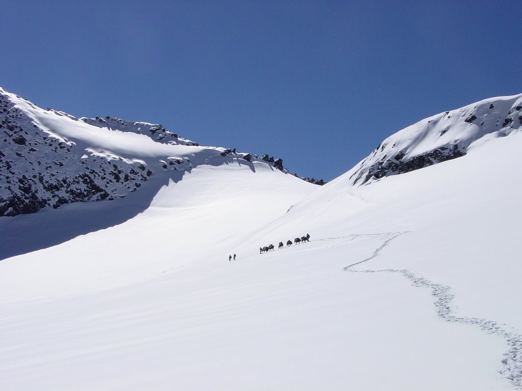
- Climbing Thamsar pass from north. Image source : http://www.panoramio.com/photo/8832708
KINGDOM OF THE BHANGALS –
Bara Bhangal, the geographically isolated central himalayan village, has been part of a bustling and prosperous kingdom during thirteenth century AD. The kingdom was named after the largest but remotest village in the valley, the Bara Bhangal. Its rulers were the Chandrabanshi rajputs ,with family surname being ‘Pal’ and capital being at Bir(2050 m). The high and precipitous walls of Bara Bhangal range kept the Bhangal valley well hidden. Its position rendered it inaccessible to its powerful neighbouring kingdoms of Kangra ,Kullu and Mandi untill mid sixteenth century. After this period, numerous attacks been made on Bhangal in a span of 300 years. In each attack the kingdom lost land as part of negotiation. By the early nineteenth century Bhangal was reduced to a tiny area, by 1854 the last direct member of the princely family had died. Subsequently ,another Bhangal ruler of legitimate but distant bloodline was awarded ‘Rai Sahib’ by the British. The present claimant to Bhangal is given a small Jagir for possession in the old Bhangal capital of Bir.
It is also thought that some of the Alexander the Great’s army had stayed back in these banks of Ravi, and settled here by marrying the local shepherds. To support the theory, people with pale skin, sharp nose, red hair, sharp and blue eyes are pretty common.
-

- Bara Bhangal village. Image source: http://edition.cnn.com/travel/article/bara-bangal-remote-himalayan-village/index.html
GEOGRAPHIC OVERVIEW –
Bara bhangal range of Kangra is part of a Central(or Lesser) himalayan main range called Dhoula Dhar. Bara bhangal range consists of a host of virgin unnamed peaks, healthy and active glaciers , glacial meadows, lakes and sparkling river-rivulets.
The melt waters of Kalihani glacier and Minkiani glacier flow north-west and south-west respectively, meet each other below Bara Bhangal village (2700 m) to procreate river Ravi. Ravi, which is also known as Iravati in vedic literatures, flows westwards from Bara Bhangal, passes through Chamba, turns south-west and eventually enters Pakistan.
About 20 kms south of Bara bhangal village, The combined melt waters from Thamsar and other peaks and Thamsar lake flows down farther south as Uhl river.Through the lush green Uhl valley of Kangra, Uhl river flows south, crosses Bir-Billing area and ultimately tributes to Beas.
The bordering area between Kangra and Kullu near Kalihani pass through which the trek initially enters the Bara Bhangal valley is presently known as Chhota Bhangal region.
The highest peak in the region is the pyramid shaped daunting Hanuman tibba(5932 m) to the north of Ravi.
-
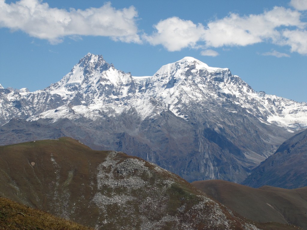
- Indrasan(L) and Deo tibba(R) to the east (not in Kangra but in Kullu), while climbing Kalihani pass. Image source : https://raobharata.files.wordpress.com/2012/10/img_2931.jpg
*No matter which way you choose for Bara Bhangal, you must cross over treacherous high altitude passes to reach or to leave the village.
Primary FOCUS in EXPLORING Bara Bhangal –
1 – Experience the old trade route that connected Manali(Kullu) to Bir(Kangra) ,via Bara Bhangal village which involved crossing of multiple high altitudes passes, negotiation of treacherous terrains while following the source watercourse of river Ravi.
2 – Know about the nomadic and spectacular lives of the Gaddhi shepherds of Himachal.
3 – Knowing the source of Ravi(Iravati), one of the “five influential rivers of Punjab”, supporting millions of lives across India and Pakistan.
4 – Remote Bara Bhangal village. The ancient and remote village has a long history of prosperity in culture/agriculture/trade etcetera, along with bloody war. A look to their old cultures and laid back but tough ways of life are some of the main takeaways from the trek.
5 – The region’s flora and fauna. It is home to a plethora of plant types; numerous species of temperate broad leaf, alpine conifer, shrub,weed,herb,grass,fern,lichen,moss and others. Animal life includes smaller terrestrials like primates,pika,rodents,badgers,weasel,martens,fox,jackal; large terrestrials like black bear,brown bear,Snow leopard,Indian leopard,Himalayan Wolf, Himalayan Ibex,Bharal etcetera. Avian animals includes Snow cock, Snow pigeon, many types of pheasants, tragopans, parakeets, redstarts, deepers, bushchats, sibeas, flycatchers, blackbirds, robins, hoopoe, chaugh, raven, falcons, sparrowhawks, eagles, harriers, vultures among many other species.
THE ITINERARY – BARA BHANGAL
Day 01: The trekkers arrive in Manali. Acclimate.
Day 02: Manali – Lama Dugh (3010m) Duration: 4 hours
Day 03: Lama Dugh – Riyali Thach (3400m) Duration: 3 hours
Day 04: Riyali Thach – Base of Kalihani Pass (4010m) Duration: 6 hours
Day 05: Base of Kalihani – Devi ki Marhi (3850m) via Kalihani Pass (4725m) Duration: 8 hours
Day 06: Devi Ki Marhi – Dal Marhi (3900m) Duration: 6 hours
Day 07: Dal Marhi – Bara Bhangal (2700m) Duration: 6 hours
Day 08: Explore Bara Bhangal. Rest.
Day 09: Bara Bhangal – Mardh (3830m) Duration: 5 hours
Day 10: Mardh – Plachak (2721m) via Thamsar Pass (4878m) Duration: 7 hours
Day 11: Reserved day.
Day 12: Plachak – Rajgundha (2440m) – Billing (2310m) Duration: 6 hours
*THE ABOVE ITINERARY IS SUBJECT TO CHANGE DEPENDING UPON WEATHER,HEALTH AND/OR OTHER FACTORS.
DETAILS OF THE TREK –
The trail during the first stage, crosses the watershed (through Kalihani pass) between Beas and Ravi to enter Bara Bhangal valley. Then it proceeds north-west to reach Bara Bhangal village. Eventually the trail comes out of the valley by recrossing the same watershed (through Thamsar pass) in an altogether different location (see map).
-
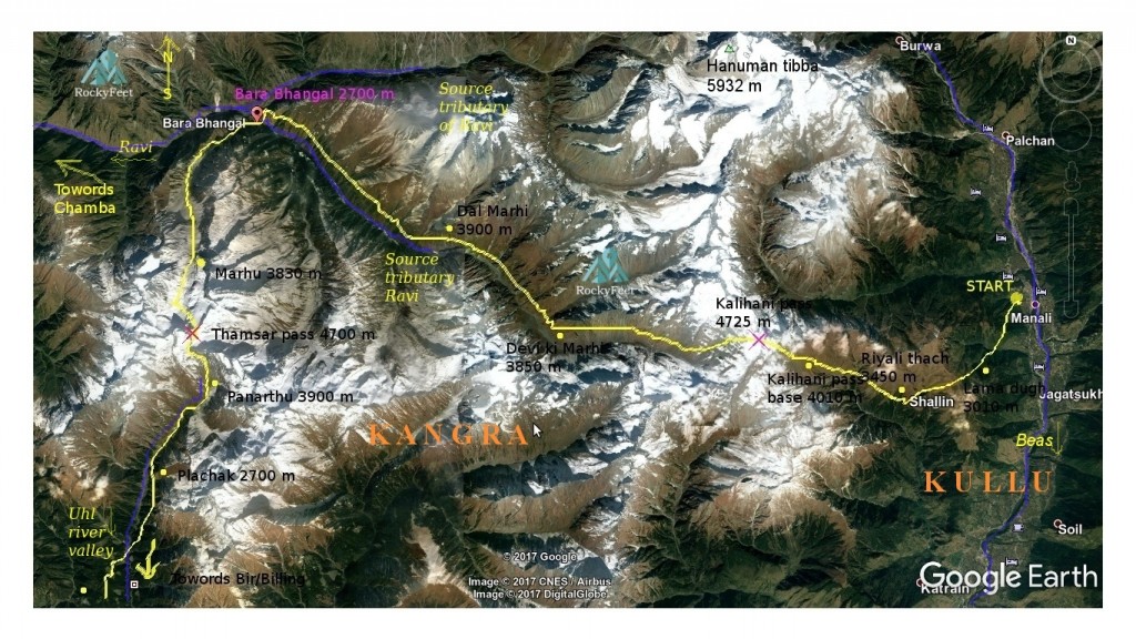
- Bara Bhangal trek route map. Base map source: Google Earth
The first two days our trail proceeds west-south-west direction until it reaches the high meadows of Riyali bugiyal.
As we start our trek from Dhungri village, Manali, we enter the lush green rich and fertile eastern himalayan temperate forest on the rising slopes of Dhoula Dhar. Distant views of mount Indrasan,Deo tibba to the east and the peaks of Bara Shigri region to north-east can be seen from the trail. Alpine shrub lands, patches of grasslands start to appear.
Beyond Lama dugh the trail climbs till about 3700 meters while crossing over a rib and descends down to Riyali thach. It is a great expanse of grassland nourished by the rich glacial soil and rain caught by the high walls of Dhaula dhar.
These alpine pastures have provided livelihood to thousands of families of Gaddi shepherds, for hundreds of generations. Their choice of cattle is Sheep ,pashmina Goat and stout short horses.The Gaddi use and sell their produce of milk-cheese-meat-leather, stays entirely dependant on its cattle and fully committed to their well being. Large herds quickly exhaust the grazing slopes. Green grass follows the rain, so does the Gaddi and its cattle. They can migrate up treacherous glacial valley, can cross over high passes to enter freshly vegetated pasture land. In rainy seasons, some migrate to the rain shadow areas into Lahaul and Spiti or sparsely vegetated areas of Bara Bhangal ,Chotta Bhangal or Kinnaur. In those months the mineral rich but otherwise dry slopes of these areas get some rain, allowing them to flourish with abundance of green shoots of grass. The cattle following the rain, make full use of it. By early November the shepherds cross back over the passes to the warmer lower pastures of Kullu, Mandi or Kangra district.
From Riyali bugiyal the trail goes north-west till Kalihani base.The trail climbs gradually over alpine slopes for couple of hours before continuing on a ridge towards north-west. After crossing a series of rocky outcrops of ziz zag formation and old frozen snow slopes we reached the flat plain of Kalihani base.
-
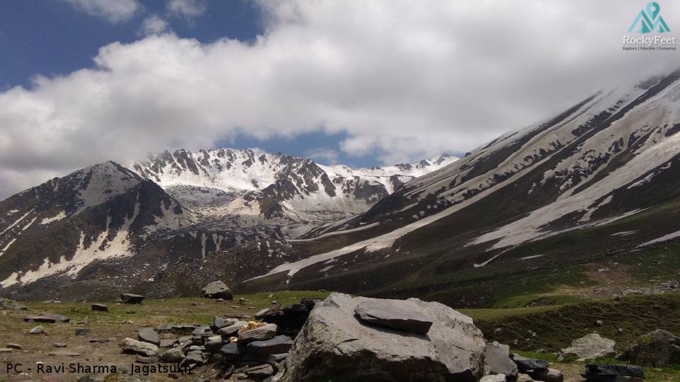
- View towards north (direction of Hanuman tibba) while climbing Kalihani pass.
As the elevation grows we hike through old moraines and scree. The going gets difficult as the air thins out. A six hour long slow and steady climb over rock and snow takes one to the Kalihani pass. From the pass, great views of Dhaula dhar to the west and peaks of greater himalayan ranges to east can be observed. The trail goes down from the pass towards west through snow covered moraines. Long,arduous march along the Kalihani nalah will take us to the intended camping site Devi ki Marhi. This Kalihani nalah is one of the sources of Ravi.
From here the trail follows the watercourse of Kalihani. Many streams and rivulets has cut down the valley laterally to enter the main nalah which presents challenges to cross. Another day of descent towards north-west takes us deep into the Bara Bhangal valley. Here , just below the village of Bara Bhangal the glacial melt waters from Minkiani and Kalihani glaciers meet, the resulting watercourse is called the mythical Iravati (Ravi).
Bara Bhangal is an old kingdom of Chandrabanshi Rajput ‘Pal’ kings, dating back to the thirteenth century AD. But it is not clear as to what was it like before the Pals. Given that it’s a rich riverine valley with potential of great yields of medicinal plants, other herbs, cereals and grass, it can be argued, that the settlement of Bara Bhangal is much older than how it is credited now. The unending, mystic stories and remains of the old trade routes to central Asia are a massive attraction and subject of interest for the romantic and the researcher.
-
- Leaving Bhangal. Upper snow fields near Thamsar
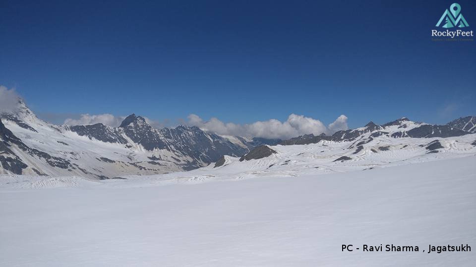
Leaving Bara Bhangal, our trail which as yet has followed a roughly westerly course, now turns south, crossing the Ravi river and following the stream upstream to south. We cross the river and come to its true right bank. We push south along the gently sloped valley full of huge boulders. The camp site Murdh is a small clearing in the middle of heaps of glacial debris and boulders.
Next morning we made early start. Slow and gradual ascent up the bleak moraines,loose scree over the banks of large pristine lakes took us to the pass in 5 hours. There was good amount of snow on the long approach of the pass. On one side of the pass there is Lantern peak, on the other Thamsar peak. The lakes and these mountains are the source of Uhl river which we shall start to follow from here.
-
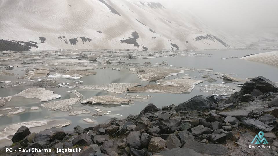
- Frozen Thamsar lake, source of Uhl
The snowy southern slopes of Thamsar pass gave way to snow less and grassy moraines. One can feel the lushness of these southern slopes of Dhaula dhar mountains which presents an obvious and stark difference from the somewhat sparsely vegetated slopes of inner Bara Bhangal. We reach the Panarthu campsite by late afternoon following the Uhl river.
Next day we descend down to Plachak at 2700 m through easy trail. From here, one has to walk down till Billing from where to get a vehicle for Dharmashala or Palampur.
Our Bara Bhangal trek will end here , Uhl river will continue to flow down towards south to eventually meet the Beas(Bipasha).
Sources:
https://en.wikipedia.org
http://edition.cnn.com/travel/article/bara-bangal-remote-himalayan-village/index.html
https://raobharata.files.wordpress.com
http://www.panoramio.com
Google books – “The Princely and Noble Families of Former Indian Empire – Mark Brentnall”
Credits:
Ravi Sharma , the gifted mountain-man from Jagatsukh, for sharing his photos and experiences.